Article Post
Origin and Cause is Changing the Game with the Use of Drones in Claim Investigations

Drones are relatively new in the investigative field, but technology has evolved dramatically. Drones are very efficient tools and can be utilized by adjusters, lawyers, and contractors. Drones help examine and document the scene for physical evidence and preserve it forensically. This is done through systematic digital video and photo collection of evidence. Often, the evidence will assist in determining the Cause of the loss and help tie up physical evidence with the information obtained. Contractors and appraisers can use drones for assessments and scoping rebuilds by preventing investigators from climbing ladders or entering hazardous locations. Drones save time and have revolutionized how data is collected. They are inexpensive and swift when it comes to data processing.
Types of Drone Deployment
Drones find applications in various investigations and can be deployed for multiple cases. They are perfect for scenarios where it would be too dangerous to send in human investigators, thus assisting with Risk Management. Drones are deployed for the following cases:
- Structural inspections such as roofs, interior, and exterior
- Difficult to reach and hazardous areas such as attics, crawlspace, and tunnels, thus mitigating hazards
- Natural disasters such as forest fires, floods, tornadoes
- Large and small scale fire investigations
- Explosions
Structural Inspections
Structural inspections can be extremely hazardous, especially if the structure fails or collapses.
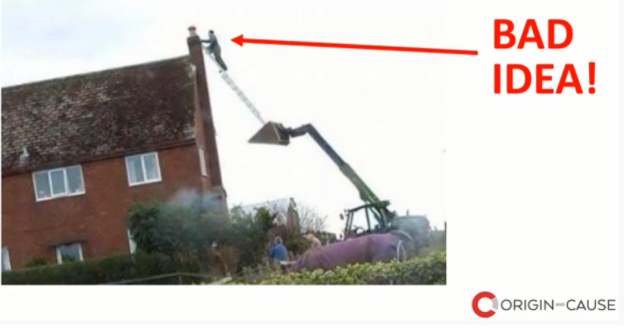
Site Safety for Contractors
Contractors will encounter hazardous situations, climb scaffoldings chimneys, inspect ice dams and all levels/floors of construction sites and buildings. In addition, some of the most equipped individuals can face risk with equipment failure. Drones are a safer and quicker alternative to collecting data in such situations.
Drones can be flown very close to structures, rooflines, and other inaccessible areas to help determine the damage and evaluate rebuilds. Drones can be passed to a maximum altitude of 400 ft above ground for overall site evaluation.
How Contractors and Adjusters Find Drones Advantageous
- Quick inspection turnaround time – Once the flight is completed, the data can be pulled from the drone using an SD where the images and videos can be reviewed on a laptop hence reducing any delays in the post-processing of the data
- Cost reduction when compared to traditional site evaluation – Time is money, and now buildings can be surveyed in 1/8th the time, along with immediate availability of data, which would otherwise take time if it were collected through photography.
- Assess more claims in a fraction of the time
- Reduce the cost of insurance inspections and claim turnaround
- Improve customer reviews with better client satisfaction. We will design a custom flight plan for you at various heights and altitudes, depending on what’s needed for the view of the claim. Customers are amazed at the clarity of the digital photos and videos
- Improve claim settlements with enhanced inspection intelligence
Information that Drones can Provide
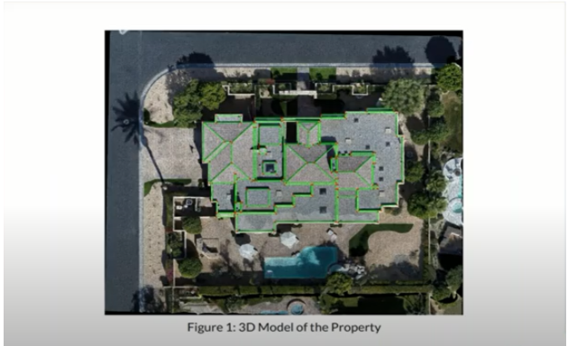
The software used by Origin and Cause provides more than just pictures and videos. Drones are capable of producing images of 4k resolution if needed. You’re assured of high image quality, even if it’s hard-to-reach spots, which can help adjusters understand the Cause of the loss and verify if there is coverage for the claim. Drones also accurately document the damage for contractors and estimators with precise measurements for rebuilds. Every roof inspector or contractor can do their job from the safety of the ground.
Drones can also provide systematic grid information, which can be rendered and recreated in 2D and 3D modeling. The technology used by Origin and Cause is the same technology used by law enforcement agencies to recreate collision scenes. We recreate scenes that surpass anyone in the industry. In addition, we can capture scenes in time that provide incredible detailing.
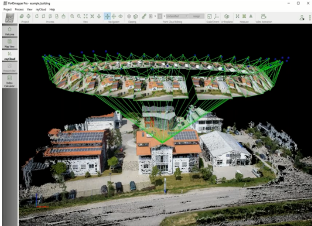
We can zoom in and zoom out of these 3D models and can even rotate them to examine them from various angles. The files can be exported, which can be shared with you via the Cloud, email, or SD card, depending on the file, this is best suited for contractors and adjusters. We provide accurate measurements, volume metrics, and area calculations with extreme accuracy. During litigation, we can reproduce this data as a time capsule of what occurred on the scene at the time of inspection.
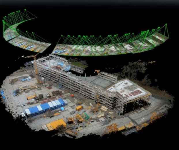
In large losses such as construction sites or when insurers have liability exposure, they want thoroughly documented evidence if it goes to litigation. This is exactly what 3D modeling allows. You have preservation of the site as it is which can be reviewed at any time in the future.
Water Claim Investigations – Thermal Imaging
Thermal imaging has been a game-changer for us. Thermal imaging can provide invisible data to an investigator. A leak that would be impossible to detect by the naked eye, can be detected by attaching a thermal imaging camera to the drone.
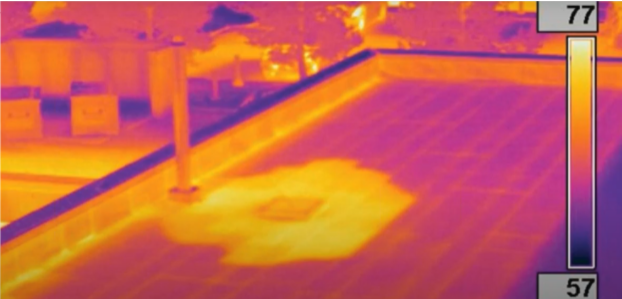
The orange gradient shows the water that has penetrated the building and increased in temperature due to the heat inside. The purple gradient shows the cooler temperature. You can see where the water penetration has happened and it helps understand the damage caused, which would otherwise be impossible to detect without thermal imaging.
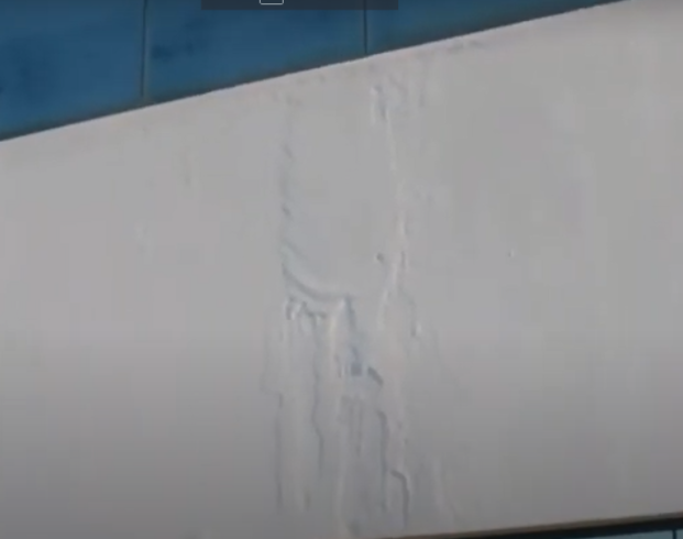
Thermal imaging gives you a spectrum to help the operator determine the hot spots and the cold spots to be able to detect the damages. Through 3D modeling, the building can be recreated as it was before the incident. The combination of both technologies can help determine the extent of water penetration. Sometimes it is not obvious where the water travels but with thermal imaging, you can understand where the water is pooling and can help engineers assess how much damage has occurred.
Inspection of Hazardous Areas
Origin and Cause can place small drones in hard-to-reach areas or hazardous structures. A site may not be accessible to an adjuster and small interior drones can be sent to inspect the area. These include:
- Attic and crawlspaces
- Access tunnels
- Flooded basements
- Electrical Hazard
- Chemical or industrial hazard
Sending in a drone reduces the risk the attending team would otherwise have to face. Time is saved and efficiency is boosted through technology deployment.
Wind Turbine Inspections
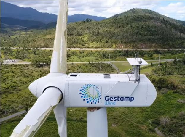
Using drones for wind turbine inspection is a relatively new concept. Wind turbine inspections are extremely time-consuming and risky for individuals but with drones, you can inspect 2-5 turbines a day. The cost of the inspection is reduced to $300-$500 as opposed to the traditional cost of $1500-$2000 where wind turbines are inspected manually. They are more accurate and extremely efficient.
Natural Disaster Claims
During natural disasters such as floods, tornadoes, hurricanes, and ice storms, adjusters will be overwhelmed by multiple claims in a very short period of time. Drone deployment will help determine the extent of the damage. The results can be live-streamed.
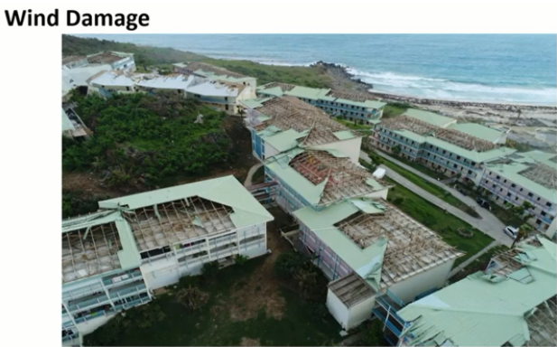
(Island of Antigua after a hurricane – captured via a drone)
Drones are deployed to areas devastated due to natural disasters. A greater aerial perspective can be provided and you can assess larger areas in a shorter period of time. We are better able to assess ground damage and deploy resources to areas that need it. More structures are examined per day with drones, with quick evidence collection.
Large and Small Scale Fires
During large or small fire incidents, drones can get to roofs if roof structure was compromised. You can still get an inspection even if the roof has collapsed. Stucco, siding, concrete damage, damaged windows, etc., that require close inspection can easily be studied through drones.
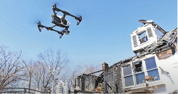
Forest Fires
Drones can also be utilized if there’s been a forest fire. It covers a large expanse of areas fairly quickly and can assess the site of damage before anyone can get in on foot. The images can be cross-referenced with risk management and underwriting information. You can also study evacuation plans, as drones can provide a wealth of visual data.
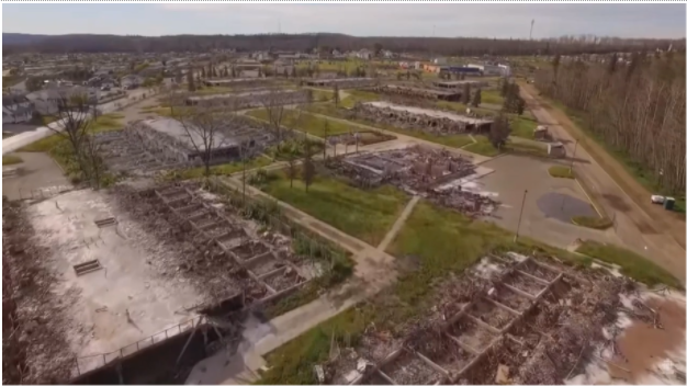
(Wildfire inspection in Alberta)
Origin and Cause – Providing High-Quality Drone Solutions
At Origin and Cause, we use state-of-the-art drones such as the DJI Inspire 2 Cinematic System. It is highly responsive, provides 4k resolution, and is Transport Canada Rated. We also use the DJI Mavic Dual Thermal System which are our smaller drones providing 1080p resolution and are equipped with a thermal imaging sensor. We also utilize the DJI Matrice 200 which are all-weather inspection drones with thermal imaging sensors and provide a 30x zoom. Our drones are top quality and our technology surpasses anyone in the field and with the advancing of drone technology, we continue to acquire the latest equipment to deliver the highest quality deliverables to our clients. Contact Origin and Cause to make use of our highly sophisticated drone services for quick turnaround time and cost-effective investigations.